
Thank you for supporting this site ❤️
Make a donation
Make a donation
Gear up for your next adventure:
As an Amazon Associate, this site earns from qualifying purchases at no extra cost to you.
Tötensen topographic map
Click on the map to display elevation.
Thank you for supporting this site ❤️
Make a donation
Make a donation
Gear up for your next adventure:
As an Amazon Associate, this site earns from qualifying purchases at no extra cost to you.
About this map
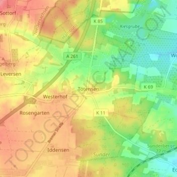
Name: Tötensen topographic map, elevation, terrain.
Location: Tötensen, Rosengarten, Harburg, Baixa Saxônia, 21224, Alemanha (53.38378 9.90538 53.42378 9.94538)
Average elevation: 236 ft
Minimum elevation: 98 ft
Maximum elevation: 371 ft
Thank you for supporting this site ❤️
Make a donation
Make a donation
Gear up for your next adventure:
As an Amazon Associate, this site earns from qualifying purchases at no extra cost to you.