Geolocate

Quicho topographic map

Click on the map to display elevation.

About this map

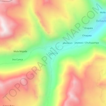
Name: Quicho topographic map, elevation, terrain.

Location: Quicho, Ollachea, Carabaya, Puno, Perú (-13.70086 -70.66746 -13.66086 -70.62746)

Average elevation: 13,766 ft

Minimum elevation: 12,152 ft

Maximum elevation: 15,282 ft

Gear up for your next adventure:

🎒Trekking Poles - Sturdy poles for balance and stability on rough terrain
🧭Pro Hiking Compasses - High-accuracy liquid-filled compasses for topographic orientation
🧷Carabiner Set - Durable clips for gear attachment
🚪Portable Camp Chair - Foldable chair for comfort at camp
🖼️Topo Map Wall Art - Decorative topographic prints of famous peaks and regions

As an Amazon Associate, this site earns from qualifying purchases at no extra cost to you.