
Thank you for supporting this site ❤️
Make a donation
Make a donation
Gear up for your next adventure:
As an Amazon Associate, this site earns from qualifying purchases at no extra cost to you.
Stepanivka topographic map
Click on the map to display elevation.
Thank you for supporting this site ❤️
Make a donation
Make a donation
Gear up for your next adventure:
As an Amazon Associate, this site earns from qualifying purchases at no extra cost to you.
About this map
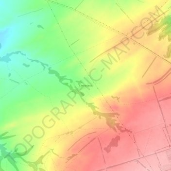
Name: Stepanivka topographic map, elevation, terrain.
Location: Stepanivka, Perevalsk Raion, Luhansk Oblast, 94320, Ukraine (48.43200 38.47703 48.47200 38.51703)
Average elevation: 860 ft
Minimum elevation: 591 ft
Maximum elevation: 1,076 ft
Thank you for supporting this site ❤️
Make a donation
Make a donation
Gear up for your next adventure:
As an Amazon Associate, this site earns from qualifying purchases at no extra cost to you.