
Thank you for supporting this site ❤️
Make a donation
Make a donation
Gear up for your next adventure:
As an Amazon Associate, this site earns from qualifying purchases at no extra cost to you.
Oni topographic map
Click on the map to display elevation.
Thank you for supporting this site ❤️
Make a donation
Make a donation
Gear up for your next adventure:
As an Amazon Associate, this site earns from qualifying purchases at no extra cost to you.
About this map
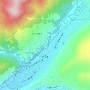
Name: Oni topographic map, elevation, terrain.
Location: Oni, Oni, Georgia, Racha-Lechkhumi and Lower Svaneti, Georgia (42.57376 43.42596 42.60472 43.46446)
Average elevation: 3,123 ft
Minimum elevation: 2,530 ft
Maximum elevation: 4,636 ft
Thank you for supporting this site ❤️
Make a donation
Make a donation
Gear up for your next adventure:
As an Amazon Associate, this site earns from qualifying purchases at no extra cost to you.