Geolocate

Reform topographic map

Click on the map to display elevation.

About this map

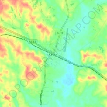
Name: Reform topographic map, elevation, terrain.

Location: Reform, Pickens County, Alabama, 35481, United States (33.34781 -88.04794 33.41001 -87.98247)

Average elevation: 279 ft

Minimum elevation: 194 ft

Maximum elevation: 407 ft

Pickens County trails, hiking, mountain biking, running and outdoor activities

Gear up for your next adventure:

🧣Hiking Neck Gaiter - Multi‑use neck protection for outdoor weather
🛠️Backpacking Tool Kit - Essential toolkit for outdoor repairs
🧤Tactile Hiking Gloves - Keep hands warm while operating GPS and smartphone screens
📷Action Cameras - Rugged cameras to document your journeys across rugged terrain
🎁Geography Themed Gifts - Unique gift ideas for map lovers and geography enthusiasts

As an Amazon Associate, this site earns from qualifying purchases at no extra cost to you.