
Thank you for supporting this site ❤️
Make a donation
Make a donation
Gear up for your next adventure:
As an Amazon Associate, this site earns from qualifying purchases at no extra cost to you.
Gramizzola topographic map
Click on the map to display elevation.
Thank you for supporting this site ❤️
Make a donation
Make a donation
Gear up for your next adventure:
As an Amazon Associate, this site earns from qualifying purchases at no extra cost to you.
About this map
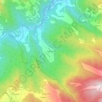
Name: Gramizzola topographic map, elevation, terrain.
Location: Gramizzola, Ottone, Piacenza, Emilia-Romagna, Italia (44.58105 9.30395 44.62105 9.34395)
Average elevation: 2,615 ft
Minimum elevation: 1,572 ft
Maximum elevation: 4,298 ft
Thank you for supporting this site ❤️
Make a donation
Make a donation
Gear up for your next adventure:
As an Amazon Associate, this site earns from qualifying purchases at no extra cost to you.