
Thank you for supporting this site ❤️
Make a donation
Make a donation
Gear up for your next adventure:
As an Amazon Associate, this site earns from qualifying purchases at no extra cost to you.
Gullfoss topographic map
Click on the map to display elevation.
Thank you for supporting this site ❤️
Make a donation
Make a donation
Gear up for your next adventure:
As an Amazon Associate, this site earns from qualifying purchases at no extra cost to you.
About this map
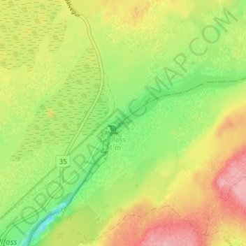
Name: Gullfoss topographic map, elevation, terrain.
Location: Gullfoss, Bláskógabyggð, Southern Region, Iceland (64.32727 -20.11915 64.32737 -20.11905)
Average elevation: 725 ft
Minimum elevation: 528 ft
Maximum elevation: 935 ft
Thank you for supporting this site ❤️
Make a donation
Make a donation
Gear up for your next adventure:
As an Amazon Associate, this site earns from qualifying purchases at no extra cost to you.