
Thank you for supporting this site ❤️
Make a donation
Make a donation
Gear up for your next adventure:
As an Amazon Associate, this site earns from qualifying purchases at no extra cost to you.
Pessinate topographic map
Click on the map to display elevation.
Thank you for supporting this site ❤️
Make a donation
Make a donation
Gear up for your next adventure:
As an Amazon Associate, this site earns from qualifying purchases at no extra cost to you.
About this map
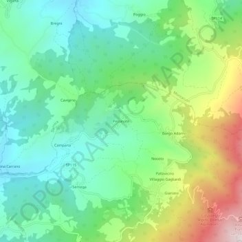
Name: Pessinate topographic map, elevation, terrain.
Location: Pessinate, Cantalupo Ligure, Alessandria, Piemonte, Italia (44.72289 9.06196 44.76289 9.10196)
Average elevation: 2,090 ft
Minimum elevation: 1,286 ft
Maximum elevation: 3,845 ft
Thank you for supporting this site ❤️
Make a donation
Make a donation
Gear up for your next adventure:
As an Amazon Associate, this site earns from qualifying purchases at no extra cost to you.