
Thank you for supporting this site ❤️
Make a donation
Make a donation
Gear up for your next adventure:
As an Amazon Associate, this site earns from qualifying purchases at no extra cost to you.
Viggsö topographic map
Click on the map to display elevation.
Thank you for supporting this site ❤️
Make a donation
Make a donation
Gear up for your next adventure:
As an Amazon Associate, this site earns from qualifying purchases at no extra cost to you.
About this map
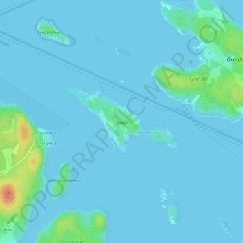
Name: Viggsö topographic map, elevation, terrain.
Location: Viggsö, Stagneudd, Värmdö kommun, Stockholm County, Sweden (59.40193 18.53196 59.40880 18.54486)
Average elevation: 16 ft
Minimum elevation: 0 ft
Maximum elevation: 164 ft
Thank you for supporting this site ❤️
Make a donation
Make a donation
Gear up for your next adventure:
As an Amazon Associate, this site earns from qualifying purchases at no extra cost to you.