
Thank you for supporting this site ❤️
Make a donation
Make a donation
Gear up for your next adventure:
As an Amazon Associate, this site earns from qualifying purchases at no extra cost to you.
Athi topographic map
Click on the map to display elevation.
Thank you for supporting this site ❤️
Make a donation
Make a donation
Gear up for your next adventure:
As an Amazon Associate, this site earns from qualifying purchases at no extra cost to you.
About this map
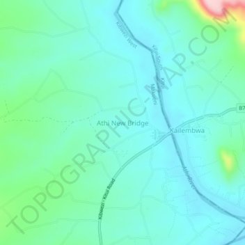
Name: Athi topographic map, elevation, terrain.
Location: Athi, Kibwezi West, Makueni, Eastern, Kenya (-2.22000 38.03000 -2.18000 38.07000)
Average elevation: 2,438 ft
Minimum elevation: 2,293 ft
Maximum elevation: 3,048 ft
Thank you for supporting this site ❤️
Make a donation
Make a donation
Gear up for your next adventure:
As an Amazon Associate, this site earns from qualifying purchases at no extra cost to you.