
Thank you for supporting this site ❤️
Make a donation
Make a donation
Gear up for your next adventure:
As an Amazon Associate, this site earns from qualifying purchases at no extra cost to you.
Tandayapa topographic map
Click on the map to display elevation.
Thank you for supporting this site ❤️
Make a donation
Make a donation
Gear up for your next adventure:
As an Amazon Associate, this site earns from qualifying purchases at no extra cost to you.
About this map
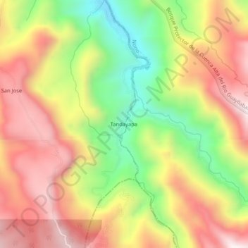
Name: Tandayapa topographic map, elevation, terrain.
Location: Tandayapa, Nanegalito, Quito Canton, Pichincha, Ecuador (-0.01696 -78.69583 0.02304 -78.65583)
Average elevation: 6,467 ft
Minimum elevation: 5,016 ft
Maximum elevation: 7,740 ft
Thank you for supporting this site ❤️
Make a donation
Make a donation
Gear up for your next adventure:
As an Amazon Associate, this site earns from qualifying purchases at no extra cost to you.