
Thank you for supporting this site ❤️
Make a donation
Make a donation
Gear up for your next adventure:
As an Amazon Associate, this site earns from qualifying purchases at no extra cost to you.
Ixtenco topographic map
Click on the map to display elevation.
Thank you for supporting this site ❤️
Make a donation
Make a donation
Gear up for your next adventure:
As an Amazon Associate, this site earns from qualifying purchases at no extra cost to you.
About this map
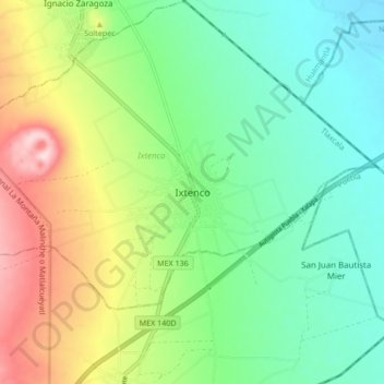
Name: Ixtenco topographic map, elevation, terrain.
Location: Ixtenco, Tlaxcala, 90590, Mexico (19.21187 -97.93476 19.29187 -97.85476)
Average elevation: 8,241 ft
Minimum elevation: 7,848 ft
Maximum elevation: 9,026 ft
Thank you for supporting this site ❤️
Make a donation
Make a donation
Gear up for your next adventure:
As an Amazon Associate, this site earns from qualifying purchases at no extra cost to you.