
Thank you for supporting this site ❤️
Make a donation
Make a donation
Gear up for your next adventure:
As an Amazon Associate, this site earns from qualifying purchases at no extra cost to you.
Kawan topographic map
Click on the map to display elevation.
Thank you for supporting this site ❤️
Make a donation
Make a donation
Gear up for your next adventure:
As an Amazon Associate, this site earns from qualifying purchases at no extra cost to you.
About this map
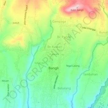
Name: Kawan topographic map, elevation, terrain.
Location: Kawan, Bangli, Bali, Lesser Sunda Islands, 80613, Indonesia (-8.47517 115.33371 -8.43517 115.37371)
Average elevation: 1,375 ft
Minimum elevation: 1,017 ft
Maximum elevation: 1,949 ft
Thank you for supporting this site ❤️
Make a donation
Make a donation
Gear up for your next adventure:
As an Amazon Associate, this site earns from qualifying purchases at no extra cost to you.