
Thank you for supporting this site ❤️
Make a donation
Make a donation
Gear up for your next adventure:
As an Amazon Associate, this site earns from qualifying purchases at no extra cost to you.
Chopta topographic map
Click on the map to display elevation.
Thank you for supporting this site ❤️
Make a donation
Make a donation
Gear up for your next adventure:
As an Amazon Associate, this site earns from qualifying purchases at no extra cost to you.
About this map
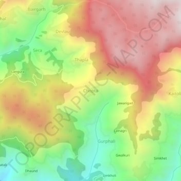
Name: Chopta topographic map, elevation, terrain.
Location: Chopta, Thailisain, Pauri Garhwal, Uttarakhand, 246275, India (29.92943 79.05824 29.96943 79.09824)
Average elevation: 6,302 ft
Minimum elevation: 4,682 ft
Maximum elevation: 7,877 ft
Thank you for supporting this site ❤️
Make a donation
Make a donation
Gear up for your next adventure:
As an Amazon Associate, this site earns from qualifying purchases at no extra cost to you.