Geolocate

Chopta topographic map

Click on the map to display elevation.

About this map

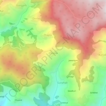
Name: Chopta topographic map, elevation, terrain.

Location: Chopta, Thailisain, Pauri Garhwal, Uttarakhand, 246275, India (29.92943 79.05824 29.96943 79.09824)

Average elevation: 6,302 ft

Minimum elevation: 4,682 ft

Maximum elevation: 7,877 ft

Gear up for your next adventure:

🕶️Glacier Sunglasses - Side shields to protect eyes from high-altitude snow glare
🔥Camping Stove - Portable stove for camping and backcountry cooking
⛑️Personal Locator Beacon - Safety beacon for emergencies
🩹Survival Bandages - High‑quality bandages for emergencies
🧣Hiking Neck Gaiter - Multi‑use neck protection for outdoor weather

As an Amazon Associate, this site earns from qualifying purchases at no extra cost to you.