Geolocate

Neffs topographic map

Click on the map to display elevation.

About this map

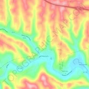
Name: Neffs topographic map, elevation, terrain.

Location: Neffs, Belmont County, Ohio, 43940, United States (40.01186 -80.83223 40.05365 -80.79425)

Average elevation: 984 ft

Minimum elevation: 669 ft

Maximum elevation: 1,289 ft

Belmont County trails, hiking, mountain biking, running and outdoor activities

Gear up for your next adventure:

🥾Hiking Shoes - Durable and comfortable shoes for trail hiking
🪶Thermal Camp Blanket - Extra warmth for cold nights
🪑Portable Camp Table - Compact table for campsite meals
🍳Camping Cook Set - Complete cookware for outdoor meals
📡GPS Antenna Upgrade - Enhance GPS reception in remote terrain

As an Amazon Associate, this site earns from qualifying purchases at no extra cost to you.