
Aguçadoura e Navais topographic map
Interactive map
Click on the map to display elevation.
About this map
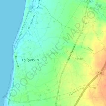
Name: Aguçadoura e Navais topographic map, elevation, terrain.
Location: Aguçadoura e Navais, Póvoa de Varzim, Porto, Portugal (41.41553 -8.78901 41.44603 -8.74553)
Average elevation: 52 ft
Minimum elevation: 0 ft
Maximum elevation: 138 ft
Other topographic maps
Click on a map to view its topography, its elevation and its terrain.
Laundos
Portugal > Porto > Póvoa de Varzim > Laundos
Laundos, Póvoa de Varzim, Porto, Portugal
Average elevation: 236 ft