
Thank you for supporting this site ❤️
Make a donation
Make a donation
Gear up for your next adventure:
As an Amazon Associate, this site earns from qualifying purchases at no extra cost to you.
Cumieira topographic map
Click on the map to display elevation.
Thank you for supporting this site ❤️
Make a donation
Make a donation
Gear up for your next adventure:
As an Amazon Associate, this site earns from qualifying purchases at no extra cost to you.
About this map
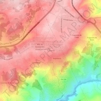
Name: Cumieira topographic map, elevation, terrain.
Location: Cumieira, Fragosela, Viseu, 3505-410, Portugal (40.60713 -7.89197 40.64713 -7.85197)
Average elevation: 1,309 ft
Minimum elevation: 755 ft
Maximum elevation: 1,591 ft
Thank you for supporting this site ❤️
Make a donation
Make a donation
Gear up for your next adventure:
As an Amazon Associate, this site earns from qualifying purchases at no extra cost to you.