
Thank you for supporting this site ❤️
Make a donation
Make a donation
Gear up for your next adventure:
As an Amazon Associate, this site earns from qualifying purchases at no extra cost to you.
Omaya topographic map
Click on the map to display elevation.
Thank you for supporting this site ❤️
Make a donation
Make a donation
Gear up for your next adventure:
As an Amazon Associate, this site earns from qualifying purchases at no extra cost to you.
About this map
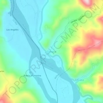
Name: Omaya topographic map, elevation, terrain.
Location: Omaya, Pichari, Province of La Convención, Cusco, Peru (-12.57926 -73.82689 -12.53926 -73.78689)
Average elevation: 2,119 ft
Minimum elevation: 1,791 ft
Maximum elevation: 3,035 ft
Thank you for supporting this site ❤️
Make a donation
Make a donation
Gear up for your next adventure:
As an Amazon Associate, this site earns from qualifying purchases at no extra cost to you.