Geolocate

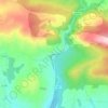
Balboa topographic map

Click on the map to display elevation.

About this map

Name: Balboa topographic map, elevation, terrain.

Location: Balboa, El Bierzo, León, Castile and León, 24525, Spain (42.66680 -6.97282 42.75957 -6.86665)

Average elevation: 3,481 ft

Minimum elevation: 2,011 ft

Maximum elevation: 5,653 ft

Other topographic maps

Click on a map to view its topography, its elevation and its terrain.

Guímara

Spain > Castile and León > El Bierzo > Peranzanes

Average elevation: 4,495 ft

Arnadelo

Spain > Castile and León > El Bierzo > Oencia

Average elevation: 2,277 ft

Finolledo

Spain > Castile and León > El Bierzo > Cubillos del Sil

Average elevation: 2,336 ft

Arlanza

Spain > Castile and León > El Bierzo > Bembibre

Average elevation: 2,638 ft

Juan Alveiro

Spain > Castile and León > El Bierzo > Noceda del Bierzo

Average elevation: 2,995 ft

Gear up for your next adventure:

🗃️Trail First Aid Kit - Essential kit for outdoor injuries and emergencies
🗺️NatGeo Topo Maps - High-quality waterproof printed topographic maps of US Parks
🩳Quick‑Dry Hiking Shorts - Comfortable and quick‑dry shorts for summer hiking
🕶️GPS Smartphone Mount - Secure mount for phone navigation
🦟Ultrasonic Repellers - Create a bug-free zone at your camp or rest stop

As an Amazon Associate, this site earns from qualifying purchases at no extra cost to you.