Geolocate

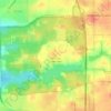
Winnebago topographic map

Click on the map to display elevation.

About this map

Name: Winnebago topographic map, elevation, terrain.

Location: Winnebago, Winnebago Township, Winnebago County, Illinois, United States (42.25424 -89.25121 42.28149 -89.20825)

Average elevation: 876 ft

Minimum elevation: 820 ft

Maximum elevation: 938 ft

Other topographic maps

Click on a map to view its topography, its elevation and its terrain.
Shirland

United States > Illinois > Winnebago County

Average elevation: 764 ft

Haight Park

United States > Illinois > Winnebago County > Rockford

Average elevation: 741 ft

Shirland

United States > Illinois > Winnebago County

Average elevation: 764 ft

Gear up for your next adventure:

🪑Portable Camp Table - Compact table for campsite meals
🚪Portable Camp Chair - Foldable chair for comfort at camp
🏕️Family Camping Gear - Essentials for group camping trips
📡Handheld GPS Device - Reliable handheld GPS for outdoor navigation
🧢Outdoor Hiking Hat - Sun protection hat for outdoor explorers

As an Amazon Associate, this site earns from qualifying purchases at no extra cost to you.