Geolocate

Masella topographic map

Click on the map to display elevation.

About this map
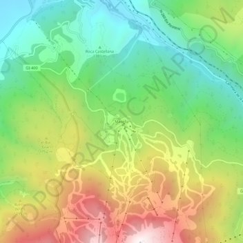
Name: Masella topographic map, elevation, terrain.

Location: Masella, Alp, Cerdaña, Gerona, Cataluña, 17538, España (42.33110 1.88122 42.37110 1.92122)

Average elevation: 5,305 ft

Minimum elevation: 3,760 ft

Maximum elevation: 7,582 ft

Gear up for your next adventure:

🛡️Insect Repellent - Protection against bugs during outdoor activities
🔦LED Headlamp - Bright and durable LED headlamp for night navigation
🧤Hiking Gloves - Protective gloves for rugged trails
🧯Emergency Survival Kit - All‑in‑one survival essentials for the backcountry
🪶Wildlife Field Guides - Learn animal tracking and species ID

As an Amazon Associate, this site earns from qualifying purchases at no extra cost to you.