Geolocate

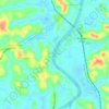
Muttuchira topographic map

Click on the map to display elevation.

About this map

Name: Muttuchira topographic map, elevation, terrain.

Location: Muttuchira, Vaikom, Kottayam, Kerala, 686604, India (9.73606 76.47935 9.77606 76.51935)

Average elevation: 72 ft

Minimum elevation: -3 ft

Maximum elevation: 230 ft

Other topographic maps

Click on a map to view its topography, its elevation and its terrain.

Dr. Ambedkar

India > Kerala > Vaikom > Arayankavu

Average elevation: 43 ft

Muvatupuzha

India > Kerala > Vaikom > Velloor

Average elevation: 46 ft

Mathanam

India > Kerala > Vaikom > Thalayolaparambu > Ulladanthara Colony

Average elevation: 16 ft

Omalloor

India > Kerala > Vaikom > Manjoor

Average elevation: 98 ft

Mulakulam

India > Kerala > Vaikom

Average elevation: 49 ft

Mundar

India > Kerala > Vaikom > Kallara

Average elevation: 3 ft

Gear up for your next adventure:

📷Action Cameras - Rugged cameras to document your journeys across rugged terrain
🛶Inflatable Kayak - Portable kayak for rivers, lakes, and expeditions
🌎3D Topographic Globes - Raised relief globes for a tactile understanding of geography
🛠️Outdoor Gear Repair Kit - Essential tools to fix gear on the trail
💧Water Purification System - Clean water on the trail with reliable purifiers

As an Amazon Associate, this site earns from qualifying purchases at no extra cost to you.