Geolocate

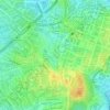
Napindan topographic map

Click on the map to display elevation.

About this map

Name: Napindan topographic map, elevation, terrain.

Location: Napindan, Tipas, Taguig District 1, Taguig, Southern Manila District, Metro Manila, Philippines (14.52456 121.08776 14.54502 121.10845)

Average elevation: 13 ft

Minimum elevation: -7 ft

Maximum elevation: 33 ft

Other topographic maps

Click on a map to view its topography, its elevation and its terrain.
Taguig River

Philippines > Taguig

Average elevation: 20 ft

BGC Greenway Park

Philippines > Taguig

Average elevation: 82 ft

Taguig River

Philippines > Taguig

Average elevation: 16 ft

De Jesus Oval

Philippines > Taguig

Average elevation: 82 ft

Tipas River

Philippines > Taguig

Average elevation: 13 ft

Taguig River

Philippines > Taguig

Average elevation: 10 ft

Daang Manunuso Creek

Philippines > Taguig

Average elevation: 16 ft

Gear up for your next adventure:

🍳Camping Cook Set - Complete cookware for outdoor meals
🥄Camping Utensil Set - Lightweight utensils for outdoor meals
🪄Magnetic Compass - Accurate compass for navigation
🛠️Backpacking Tool Kit - Essential toolkit for outdoor repairs
🏕️Tent Footprint - Protect your tent base from wear

As an Amazon Associate, this site earns from qualifying purchases at no extra cost to you.