
Mangart topographic map
Interactive map
Click on the map to display elevation.
About this map
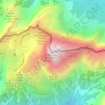
Name: Mangart topographic map, elevation, terrain.
Location: Mangart, Flitsch, Slowenien (46.43941 13.65460 46.43951 13.65470)
Average elevation: 5,906 ft
Minimum elevation: 3,835 ft
Maximum elevation: 8,737 ft
Other topographic maps
Click on a map to view its topography, its elevation and its terrain.