Geolocate

Seichamps topographic map

Click on the map to display elevation.

About this map
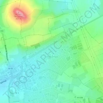
Name: Seichamps topographic map, elevation, terrain.

Location: Seichamps, Nancy, Meurthe-et-Moselle, Grand Est, Metropolitan France, 54280, France (48.70647 6.24838 48.72539 6.29333)

Average elevation: 804 ft

Minimum elevation: 676 ft

Maximum elevation: 1,135 ft

Other topographic maps

Click on a map to view its topography, its elevation and its terrain.

Gear up for your next adventure:

📻Weather Alert Radios - Stay informed of storm risks while off-the-grid
🎒Gear Packing Cubes - Organize your backpack efficiently
⛑️Personal Locator Beacon - Safety beacon for emergencies
❄️Traction Cleats - Prevent slips on icy trails during winter hikes
🎁Geography Themed Gifts - Unique gift ideas for map lovers and geography enthusiasts

As an Amazon Associate, this site earns from qualifying purchases at no extra cost to you.