Geolocate

Mandelbachtal topographic map

Click on the map to display elevation.

About this map
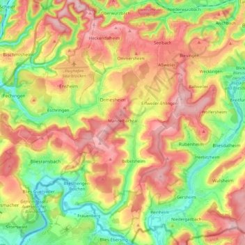
Name: Mandelbachtal topographic map, elevation, terrain.

Location: Mandelbachtal, Saarpfalz-Kreis, Saarland, 66399, Germany (49.12041 7.10087 49.25038 7.20311)

Average elevation: 965 ft

Minimum elevation: 640 ft

Maximum elevation: 1,306 ft

Gear up for your next adventure:

🎒Trail Energy Bars - High‑calorie bars for hiking energy
🕶️Glacier Sunglasses - Side shields to protect eyes from high-altitude snow glare
⛺Backpacking Tent - Lightweight and durable tent for multi‑day hikes
🧭Outdoor Navigation Book - Learn advanced navigation skills
🔪Outdoor Multitools - Essential survival tools for gear repair and field use

As an Amazon Associate, this site earns from qualifying purchases at no extra cost to you.