Geolocate

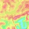
Phú Long topographic map

Click on the map to display elevation.

About this map

Name: Phú Long topographic map, elevation, terrain.

Location: Phú Long, Lâm Đồng Province, 77120, Vietnam (10.93453 108.10489 11.01453 108.18489)

Average elevation: 82 ft

Minimum elevation: -3 ft

Maximum elevation: 410 ft

Other topographic maps

Click on a map to view its topography, its elevation and its terrain.

Xã Bảo Lâm 1

Vietnam > Lâm Đồng Province

Average elevation: 2,818 ft

Xã Ka Đô

Vietnam > Lâm Đồng Province

Average elevation: 3,156 ft

Xã Hàm Liêm

Vietnam > Lâm Đồng Province

Average elevation: 115 ft

Xã Lạc Dương

Vietnam > Lâm Đồng Province

Average elevation: 4,216 ft

Bảo Lộc

Vietnam > Lâm Đồng Province > Phường B'Lao

Average elevation: 2,674 ft

Bảo Lộc

Vietnam > Lâm Đồng Province > Phường B'Lao

Average elevation: 2,674 ft

Bảo Lộc

Vietnam > Lâm Đồng Province

Average elevation: 2,674 ft

Xã Tà Năng

Vietnam > Lâm Đồng Province

Average elevation: 3,258 ft

Xã Hàm Kiệm

Vietnam > Lâm Đồng Province

Average elevation: 184 ft

Bảo Lộc

Vietnam > Lâm Đồng Province > Phường B'Lao

Average elevation: 2,674 ft

Đà Lạt

Vietnam > Lâm Đồng Province

Average elevation: 4,337 ft

Di Linh

Vietnam > Lâm Đồng Province > Di Linh District

Di Linh district is bordered by Duc Trong district to the east, Bao Lam district to the west, Binh Thuan province to the south, and Dak Nong and Lam Ha districts to the north. The district has a diverse terrain, consisting of mainly two types of topography: Binh Son Nguyen topography and high mountain terrain.…

Average elevation: 3,123 ft

Xã Đam Rông 4

Vietnam > Lâm Đồng Province

Average elevation: 3,796 ft

Xã Bảo Lâm 2

Vietnam > Lâm Đồng Province

Average elevation: 2,730 ft

Phường B'Lao

Vietnam > Lâm Đồng Province

Average elevation: 2,657 ft

Xã Hàm Kiệm

Vietnam > Lâm Đồng Province

Average elevation: 184 ft

Đắk Nông Province

Vietnam > Lâm Đồng Province

Đắk Nông is about 500m above sea level in elevation. The terrain is lower in the west. Đắk Nông has large fields and lakes in the south. Đắk Nông has three main river systems: the Ba River, the Srepok (or Sêrêpôk) river (part of the Mekong river basin) and Đồng Nai river demarking the…

Average elevation: 2,001 ft

Xã Hồng Sơn

Vietnam > Lâm Đồng Province

Average elevation: 308 ft

Xã Hàm Kiệm

Vietnam > Lâm Đồng Province

Average elevation: 184 ft

Xã Hồng Sơn

Vietnam > Lâm Đồng Province

Average elevation: 308 ft

Xã Hàm Kiệm

Vietnam > Lâm Đồng Province

Average elevation: 184 ft

Đà Lạt

Vietnam > Lâm Đồng Province

Average elevation: 4,337 ft

Xã Hồng Sơn

Vietnam > Lâm Đồng Province

Average elevation: 308 ft

Bảo Lộc

Vietnam > Lâm Đồng Province

Average elevation: 2,674 ft

Phường 10

Vietnam > Lâm Đồng Province > Da Lat City

Average elevation: 4,590 ft

Xã Lộc Thanh

Vietnam > Lâm Đồng Province > Bảo Lộc

Average elevation: 2,677 ft

Xã Hàm Kiệm

Vietnam > Lâm Đồng Province

Average elevation: 184 ft

Đạ Huoai District

Vietnam > Lâm Đồng Province

Average elevation: 1,391 ft

Đập Đa Nhim

Vietnam > Lâm Đồng Province > Xã D'Ran > D'Ran

Average elevation: 3,468 ft

Đắk Nông Province

Vietnam > Lâm Đồng Province

Đắk Nông is about 500m above sea level in elevation. The terrain is lower in the west. Đắk Nông has large fields and lakes in the south. Đắk Nông has three main river systems: the Ba River, the Srepok (or Sêrêpôk) river (part of the Mekong river basin) and Đồng Nai river demarking the…

Average elevation: 2,001 ft
Xã Lộc Châu

Vietnam > Lâm Đồng Province > Bảo Lộc

Average elevation: 2,730 ft

Gear up for your next adventure:

🛏️Cold Weather Sleeping Bag - Warm sleeping bag for cold conditions
🧣Merino Neck Gaiters - Multi-functional headwear for wind and sun protection
🦟Ultrasonic Repellers - Create a bug-free zone at your camp or rest stop
🥾Men's Hiking Boots - Durable, waterproof footwear for rugged terrain and steep inclines
🧣Hiking Neck Gaiter - Multi‑use neck protection for outdoor weather

As an Amazon Associate, this site earns from qualifying purchases at no extra cost to you.