
Thank you for supporting this site ❤️
Make a donation
Make a donation
Gear up for your next adventure:
As an Amazon Associate, this site earns from qualifying purchases at no extra cost to you.
Fatai topographic map
Click on the map to display elevation.
Thank you for supporting this site ❤️
Make a donation
Make a donation
Gear up for your next adventure:
As an Amazon Associate, this site earns from qualifying purchases at no extra cost to you.
About this map
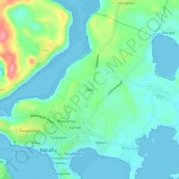
Name: Fatai topographic map, elevation, terrain.
Location: Fatai, Neiafu, Vahe Neiafu, Vavaʻu, Tonga (-18.65805 -173.99350 -18.61805 -173.95350)
Average elevation: 82 ft
Minimum elevation: -3 ft
Maximum elevation: 361 ft
Thank you for supporting this site ❤️
Make a donation
Make a donation
Gear up for your next adventure:
As an Amazon Associate, this site earns from qualifying purchases at no extra cost to you.