
Beachley topographic map
Click on the map to display elevation.
About this map
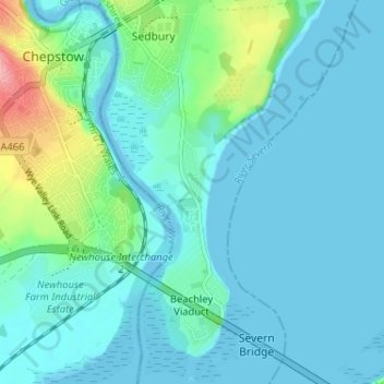
Name: Beachley topographic map, elevation, terrain.
Average elevation: 43 ft
Minimum elevation: -43 ft
Maximum elevation: 338 ft
Other topographic maps
Click on a map to view its topography, its elevation and its terrain.
Cinderford Skate Park
United Kingdom > England > Gloucestershire > Forest of Dean District > Cinderford
Average elevation: 650 ft