
Thank you for supporting this site ❤️
Make a donation
Make a donation
Gear up for your next adventure:
As an Amazon Associate, this site earns from qualifying purchases at no extra cost to you.
Ayllón topographic map
Click on the map to display elevation.
Thank you for supporting this site ❤️
Make a donation
Make a donation
Gear up for your next adventure:
As an Amazon Associate, this site earns from qualifying purchases at no extra cost to you.
About this map
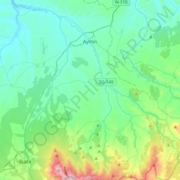
Name: Ayllón topographic map, elevation, terrain.
Location: Ayllón, Segovia, Castile and León, 40520, Spain (41.25768 -3.45287 41.46755 -3.20693)
Average elevation: 3,684 ft
Minimum elevation: 3,009 ft
Maximum elevation: 6,588 ft
Thank you for supporting this site ❤️
Make a donation
Make a donation
Gear up for your next adventure:
As an Amazon Associate, this site earns from qualifying purchases at no extra cost to you.