Geolocate

Looe topographic map

Click on the map to display elevation.

About this map

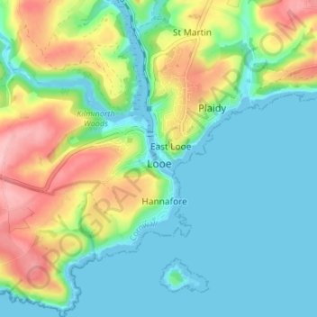
Name: Looe topographic map, elevation, terrain.

Location: Looe, Cornwall, England, United Kingdom (50.33188 -4.48683 50.37404 -4.43538)

Average elevation: 144 ft

Minimum elevation: -3 ft

Maximum elevation: 463 ft

Gear up for your next adventure:

🌎3D Topographic Globes - Raised relief globes for a tactile understanding of geography
🧦Hiking Socks - Comfortable socks to prevent blisters on long hikes
🪶Survival Guide Book - Expert advice for emergency preparedness
🪶Trail Camera - Capture wildlife on your hikes
🌧️Backpack Rain Cover - Keep gear dry in wet weather

As an Amazon Associate, this site earns from qualifying purchases at no extra cost to you.