
Thank you for supporting this site ❤️
Make a donation
Make a donation
Gear up for your next adventure:
As an Amazon Associate, this site earns from qualifying purchases at no extra cost to you.
Maumere topographic map
Click on the map to display elevation.
Thank you for supporting this site ❤️
Make a donation
Make a donation
Gear up for your next adventure:
As an Amazon Associate, this site earns from qualifying purchases at no extra cost to you.
About this map
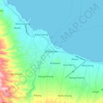
Name: Maumere topographic map, elevation, terrain.
Location: Maumere, Sikka, East Nusa Tenggara, 86111, Indonesia (-8.66565 122.17929 -8.58565 122.25929)
Average elevation: 174 ft
Minimum elevation: 0 ft
Maximum elevation: 922 ft
Thank you for supporting this site ❤️
Make a donation
Make a donation
Gear up for your next adventure:
As an Amazon Associate, this site earns from qualifying purchases at no extra cost to you.