
Ruth topographic map
Click on the map to display elevation.
Ruth
Ruth is a census-designated place (CDP) in Trinity County, California.[2] Ruth is located in the southern portion of the county. The community - and adjacent Ruth Lake - was named after Ruth McKnight, daughter of settlers. The ZIP code is 95526.[3] The community is inside area code 707. It is located near the headwaters of the Mad River (California) and adjacent to the Yolla Bolly-Middle Eel Wilderness. Ruth sits at an elevation of 2,933 feet (894 m).[2] Its population is 254 as of the 2020 census, up from 195 from the 2010 census.
About this map
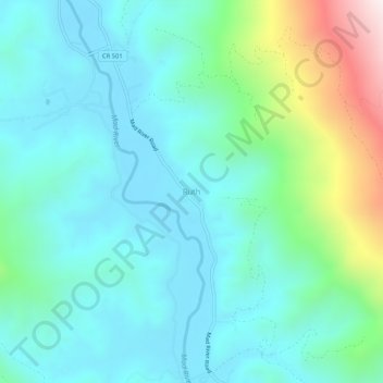
Name: Ruth topographic map, elevation, terrain.
Location: Ruth, Trinity County, California, United States (40.24959 -123.34141 40.28959 -123.30141)
Average elevation: 3,268 ft
Minimum elevation: 2,671 ft
Maximum elevation: 5,466 ft
Trinity County trails, hiking, mountain biking, running and outdoor activities
Other topographic maps
Click on a map to view its topography, its elevation and its terrain.
Whiskeytown-Shasta-Trinity National Recreation Area - Trinity Unit
United States > California > Trinity County
Average elevation: 3,770 ft