
Thank you for supporting this site ❤️
Make a donation
Make a donation
Gear up for your next adventure:
As an Amazon Associate, this site earns from qualifying purchases at no extra cost to you.
Tawain topographic map
Click on the map to display elevation.
Thank you for supporting this site ❤️
Make a donation
Make a donation
Gear up for your next adventure:
As an Amazon Associate, this site earns from qualifying purchases at no extra cost to you.
About this map
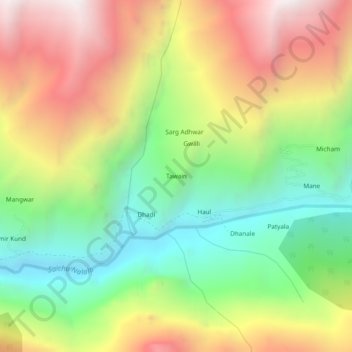
Name: Tawain topographic map, elevation, terrain.
Location: Tawain, Pangi, Chamba District, Himachal Pradesh, India (32.96707 76.48334 33.00707 76.52334)
Average elevation: 10,348 ft
Minimum elevation: 7,943 ft
Maximum elevation: 13,291 ft
Thank you for supporting this site ❤️
Make a donation
Make a donation
Gear up for your next adventure:
As an Amazon Associate, this site earns from qualifying purchases at no extra cost to you.