
Thank you for supporting this site ❤️
Make a donation
Make a donation
Gear up for your next adventure:
As an Amazon Associate, this site earns from qualifying purchases at no extra cost to you.
Huye topographic map
Click on the map to display elevation.
Thank you for supporting this site ❤️
Make a donation
Make a donation
Gear up for your next adventure:
As an Amazon Associate, this site earns from qualifying purchases at no extra cost to you.
About this map
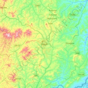
Name: Huye topographic map, elevation, terrain.
Location: Huye, Ngoma, Huye, Southern Province, Rwanda (-2.76534 29.58015 -2.44534 29.90015)
Average elevation: 5,463 ft
Minimum elevation: 4,459 ft
Maximum elevation: 7,808 ft
Thank you for supporting this site ❤️
Make a donation
Make a donation
Gear up for your next adventure:
As an Amazon Associate, this site earns from qualifying purchases at no extra cost to you.