
Maple topographic map
Click on the map to display elevation.
About this map
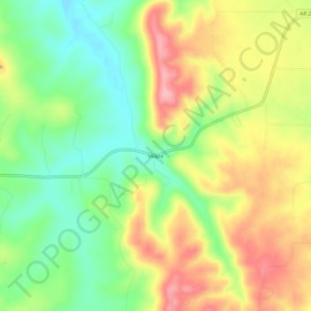
Name: Maple topographic map, elevation, terrain.
Location: Maple, Carroll County, Arkansas, United States (36.41479 -93.51741 36.45479 -93.47741)
Average elevation: 1,293 ft
Minimum elevation: 1,083 ft
Maximum elevation: 1,539 ft
Carroll County trails, hiking, mountain biking, running and outdoor activities