Geolocate

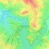
Fraser topographic map

Click on the map to display elevation.

Fraser

Mount Rogers reserve is part of Fraser with an elevation of 704 metres (2,310 ft). Fraser has a neighbourhood oval and primary school. It is bordered to the north by Kuringa Drive.

Wikipedia (CC-BY-SA 3.0)

About this map

Name: Fraser topographic map, elevation, terrain.

Location: Fraser, District of Belconnen, Australian Capital Territory, Australia (-35.20116 149.03104 -35.18265 149.05890)

Average elevation: 2,008 ft

Minimum elevation: 1,860 ft

Maximum elevation: 2,313 ft

Other topographic maps

Click on a map to view its topography, its elevation and its terrain.
Diddams Close Park

Australia > District of Belconnen

Average elevation: 1,932 ft

Ginninderra Creek

Australia > District of Belconnen

Average elevation: 1,929 ft

Gossan Hill

Australia > District of Belconnen

Average elevation: 2,041 ft

Mount Rogers

Australia > District of Belconnen

Mount Rogers is a large hill, with an elevation of 704 metres (2,310 ft), located in the northern suburbs of Canberra, within the Australian Capital Territory, Australia. There is a park called the Mount Rogers Reserve at the crest of the hill, and a trig point at the summit.

Average elevation: 2,034 ft

Gear up for your next adventure:

🧥Waterproof Jacket for Hiking - Breathable and rugged rain jacket for outdoor excursions
🦶Carbon Trekking Poles - Reduce knee impact on steep descents with ultra-light poles
🪑Ultralight Camp Chairs - Portable seating for resting after a long day of mapping
📶Satellite Messenger - Communication device off‑grid
🧷Carabiner Set - Durable clips for gear attachment

As an Amazon Associate, this site earns from qualifying purchases at no extra cost to you.