
Montelungo topographic map
Interactive map
Click on the map to display elevation.
About this map
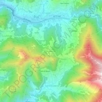
Name: Montelungo topographic map, elevation, terrain.
Location: Montelungo, Media Val Bisagno, Genoa, Liguria, 16165, Italy (44.41597 8.99240 44.45597 9.03240)
Average elevation: 925 ft
Minimum elevation: 167 ft
Maximum elevation: 2,546 ft
Other topographic maps
Click on a map to view its topography, its elevation and its terrain.