
Thank you for supporting this site ❤️
Make a donation
Make a donation
Gear up for your next adventure:
As an Amazon Associate, this site earns from qualifying purchases at no extra cost to you.
Puthumala topographic map
Click on the map to display elevation.
Thank you for supporting this site ❤️
Make a donation
Make a donation
Gear up for your next adventure:
As an Amazon Associate, this site earns from qualifying purchases at no extra cost to you.
About this map
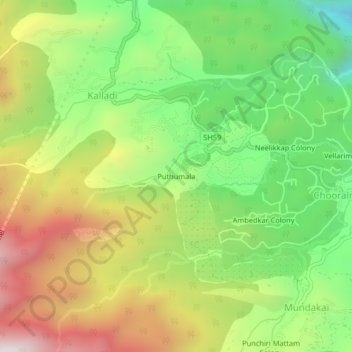
Name: Puthumala topographic map, elevation, terrain.
Location: Puthumala, Kalladi, Vythiri, Wayanad, Kerala, 673567, India (11.48133 76.12061 11.52133 76.16061)
Average elevation: 3,278 ft
Minimum elevation: 1,772 ft
Maximum elevation: 5,184 ft
Thank you for supporting this site ❤️
Make a donation
Make a donation
Gear up for your next adventure:
As an Amazon Associate, this site earns from qualifying purchases at no extra cost to you.