
Make a donation
Gear up for your next adventure:
As an Amazon Associate, this site earns from qualifying purchases at no extra cost to you.
Ramersbach topographic map
Click on the map to display elevation.
Make a donation
Gear up for your next adventure:
As an Amazon Associate, this site earns from qualifying purchases at no extra cost to you.
Ramersbach
Ramersbach liegt ca. 8 km südlich der Kernstadtteile von Bad Neuenahr-Ahrweiler am Kreuzungspunkt der Landesstraßen 84 und 85 und bildet den geographisch höchstgelegenen (der topographisch höchste Punkt heißt „Häuschen“ auf einer Höhe von 506,5 m ü. NHN), geschichtlich jedoch jüngsten Stadtteil von Bad Neuenahr-Ahrweiler.
Make a donation
Gear up for your next adventure:
As an Amazon Associate, this site earns from qualifying purchases at no extra cost to you.
About this map
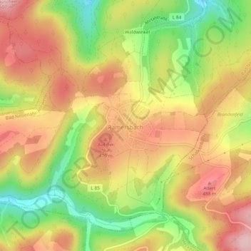
Name: Ramersbach topographic map, elevation, terrain.
Average elevation: 1,358 ft
Minimum elevation: 978 ft
Maximum elevation: 1,667 ft
Make a donation
Gear up for your next adventure:
As an Amazon Associate, this site earns from qualifying purchases at no extra cost to you.
Other topographic maps
Click on a map to view its topography, its elevation and its terrain.
Landskrone
Deutschland > Rheinland-Pfalz > Landkreis Ahrweiler > Bad Neuenahr-Ahrweiler
Ahrschleife bei Altenahr | An der Teufelsley | Aremberg | Bausenberg | Dachsbusch | Hohe Acht | Hürs-Nück | In der Burwies | Laacher See | Landskrone | Lehrenkopf | Meirother Kopf und Tiefenstein | Mündungsgebiet der Ahr | Nürburg | Quiddelbacher Höhe / Nürburgring | Olbrück | Perler Kopf | Quellgebiet…
Average elevation: 423 ft
Neuenahrer Berg
Deutschland > Rheinland-Pfalz > Landkreis Ahrweiler > Bad Neuenahr-Ahrweiler
Average elevation: 699 ft