
Thank you for supporting this site ❤️
Make a donation
Make a donation
Gear up for your next adventure:
As an Amazon Associate, this site earns from qualifying purchases at no extra cost to you.
Serpiedo topographic map
Click on the map to display elevation.
Thank you for supporting this site ❤️
Make a donation
Make a donation
Gear up for your next adventure:
As an Amazon Associate, this site earns from qualifying purchases at no extra cost to you.
About this map
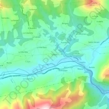
Name: Serpiedo topographic map, elevation, terrain.
Location: Serpiedo, Coya, Piloña, Asturias, 33534, España (43.34576 -5.42195 43.38576 -5.38195)
Average elevation: 925 ft
Minimum elevation: 495 ft
Maximum elevation: 2,054 ft
Thank you for supporting this site ❤️
Make a donation
Make a donation
Gear up for your next adventure:
As an Amazon Associate, this site earns from qualifying purchases at no extra cost to you.