Geolocate

Puncan topographic map

Click on the map to display elevation.

About this map

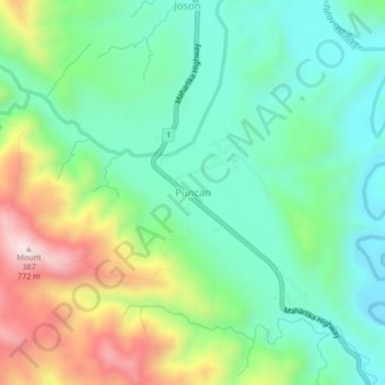
Name: Puncan topographic map, elevation, terrain.

Location: Puncan, Carranglan, Nueva Ecija, Central Luzon, Philippines (15.88615 120.97185 15.92615 121.01185)

Average elevation: 1,247 ft

Minimum elevation: 627 ft

Maximum elevation: 2,536 ft

Gear up for your next adventure:

🛰️Handheld GPS Units - Professional satellite navigators for precise backcountry mapping
📷Action Cameras - Rugged cameras to document your journeys across rugged terrain
📻Weather Alert Radios - Stay informed of storm risks while off-the-grid
🛶Inflatable Kayak - Portable kayak for rivers, lakes, and expeditions
🛌Ultralight Sleeping Bags - Compact down bags for cold nights in the wilderness

As an Amazon Associate, this site earns from qualifying purchases at no extra cost to you.