
Thank you for supporting this site ❤️
Make a donation
Make a donation
Gear up for your next adventure:
As an Amazon Associate, this site earns from qualifying purchases at no extra cost to you.
Chetaibi topographic map
Click on the map to display elevation.
Thank you for supporting this site ❤️
Make a donation
Make a donation
Gear up for your next adventure:
As an Amazon Associate, this site earns from qualifying purchases at no extra cost to you.
About this map
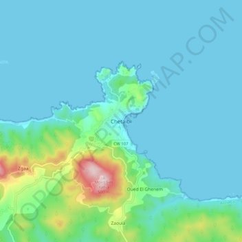
Name: Chetaibi topographic map, elevation, terrain.
Location: Chetaibi, Chetaïbi, Daïra Chetaibi, Annaba, 23014, Algérie (37.02504 7.33998 37.10504 7.41998)
Average elevation: 256 ft
Minimum elevation: 0 ft
Maximum elevation: 1,775 ft
Thank you for supporting this site ❤️
Make a donation
Make a donation
Gear up for your next adventure:
As an Amazon Associate, this site earns from qualifying purchases at no extra cost to you.