
Thank you for supporting this site ❤️
Make a donation
Make a donation
Gear up for your next adventure:
As an Amazon Associate, this site earns from qualifying purchases at no extra cost to you.
Shambala topographic map
Click on the map to display elevation.
Thank you for supporting this site ❤️
Make a donation
Make a donation
Gear up for your next adventure:
As an Amazon Associate, this site earns from qualifying purchases at no extra cost to you.
About this map
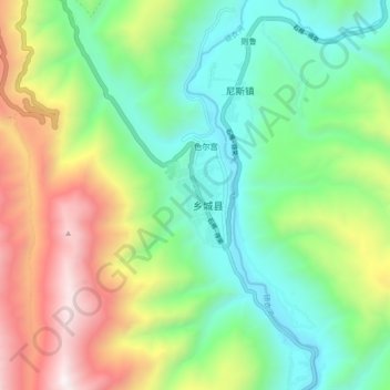
Name: Shambala topographic map, elevation, terrain.
Location: Shambala, Xiangcheng County, Sichuan, 627850, China (28.89536 99.75826 28.97536 99.83826)
Average elevation: 11,086 ft
Minimum elevation: 8,944 ft
Maximum elevation: 15,066 ft
Thank you for supporting this site ❤️
Make a donation
Make a donation
Gear up for your next adventure:
As an Amazon Associate, this site earns from qualifying purchases at no extra cost to you.