
Thank you for supporting this site ❤️
Make a donation
Make a donation
Gear up for your next adventure:
As an Amazon Associate, this site earns from qualifying purchases at no extra cost to you.
Neerijnen topographic map
Click on the map to display elevation.
Thank you for supporting this site ❤️
Make a donation
Make a donation
Gear up for your next adventure:
As an Amazon Associate, this site earns from qualifying purchases at no extra cost to you.
About this map
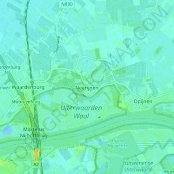
Name: Neerijnen topographic map, elevation, terrain.
Location: Neerijnen, West Betuwe, Gelderland, Nederland, 4182, Nederland (51.81129 5.25939 51.85129 5.29939)
Average elevation: 13 ft
Minimum elevation: -26 ft
Maximum elevation: 62 ft
Thank you for supporting this site ❤️
Make a donation
Make a donation
Gear up for your next adventure:
As an Amazon Associate, this site earns from qualifying purchases at no extra cost to you.