
Municipio Autónomo Atures topographic map
Click on the map to display elevation.
About this map
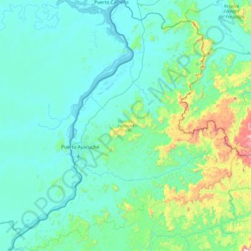
Name: Municipio Autónomo Atures topographic map, elevation, terrain.
Location: Municipio Autónomo Atures, Amazonas State, 7101, Venezuela (5.26910 -67.85021 6.19759 -67.00967)
Average elevation: 594 ft
Minimum elevation: 118 ft
Maximum elevation: 4,052 ft
Other topographic maps
Click on a map to view its topography, its elevation and its terrain.
Cerro Delgado Chalbaud
Venezuela > Amazonas State > Municipio Autónomo Alto Orinoco
Average elevation: 3,058 ft