
Thank you for supporting this site ❤️
Make a donation
Make a donation
Gear up for your next adventure:
As an Amazon Associate, this site earns from qualifying purchases at no extra cost to you.
Begues topographic map
Click on the map to display elevation.
Thank you for supporting this site ❤️
Make a donation
Make a donation
Gear up for your next adventure:
As an Amazon Associate, this site earns from qualifying purchases at no extra cost to you.
About this map
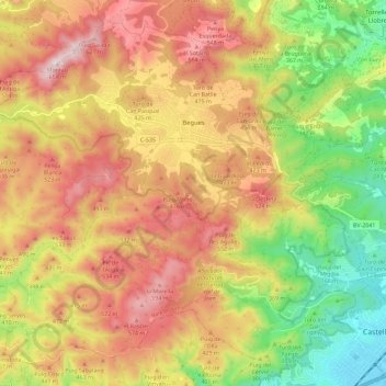
Name: Begues topographic map, elevation, terrain.
Location: Begues, Baix Llobregat, Barcelona, Catalonia, 08859, Spain (41.27823 1.84673 41.35582 1.96131)
Average elevation: 1,109 ft
Minimum elevation: 10 ft
Maximum elevation: 2,146 ft
Thank you for supporting this site ❤️
Make a donation
Make a donation
Gear up for your next adventure:
As an Amazon Associate, this site earns from qualifying purchases at no extra cost to you.