
Make a donation
Gear up for your next adventure:
As an Amazon Associate, this site earns from qualifying purchases at no extra cost to you.
Richen topographic map
Click on the map to display elevation.
Make a donation
Gear up for your next adventure:
As an Amazon Associate, this site earns from qualifying purchases at no extra cost to you.
About this map
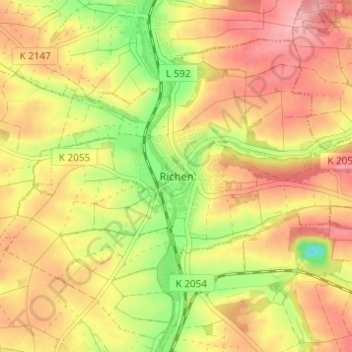
Name: Richen topographic map, elevation, terrain.
Average elevation: 702 ft
Minimum elevation: 472 ft
Maximum elevation: 866 ft
Make a donation
Gear up for your next adventure:
As an Amazon Associate, this site earns from qualifying purchases at no extra cost to you.
Other topographic maps
Click on a map to view its topography, its elevation and its terrain.
Adelshofen
Deutschland > Baden-Württemberg > Landkreis Heilbronn > Eppingen
Adelshofen liegt am Nesselbach, einem Zufluss des Hilsbaches, inmitten der Hügellandschaft des Kraichgaus. Das Dorf liegt auf einer Höhe von 216 m ü. NN.
Average elevation: 732 ft
Make a donation
Gear up for your next adventure:
As an Amazon Associate, this site earns from qualifying purchases at no extra cost to you.