
Thank you for supporting this site ❤️
Make a donation
Make a donation
Gear up for your next adventure:
As an Amazon Associate, this site earns from qualifying purchases at no extra cost to you.
Canceles topographic map
Click on the map to display elevation.
Thank you for supporting this site ❤️
Make a donation
Make a donation
Gear up for your next adventure:
As an Amazon Associate, this site earns from qualifying purchases at no extra cost to you.
About this map
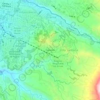
Name: Canceles topographic map, elevation, terrain.
Location: Canceles, Pereira, Risaralda, Región Andina, 660003, Colombia (4.77594 -75.69467 4.81594 -75.65467)
Average elevation: 4,905 ft
Minimum elevation: 4,449 ft
Maximum elevation: 6,099 ft
Thank you for supporting this site ❤️
Make a donation
Make a donation
Gear up for your next adventure:
As an Amazon Associate, this site earns from qualifying purchases at no extra cost to you.